Hell, NO
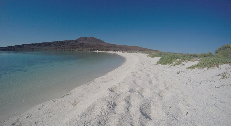
Coronado’s volcanic cone is one of those landmark peaks that just calls to you. OK to me, not Brian. “Hike me!” “Come on - the view is priceless!” While the island trail sign indicates a 650ft height, online sources differ widely on the peak’s actual height: 928ft, 1554ft 1444ft, 600ft. I’m thinking the 900ft is the most accurate. However high this thing really is, it’s high. Every year we’d anchor here on the way down the Sea and again on the way back up. Each time I’d cheerfully suggest, “Hey, let’s hike to the top!” Each time, I’d be rebuked with not just “No”, but a resounding “Hell, NO!!!”
The Perfect Excuse
Today, our snorkeling plans got nixed due to chilly water and air temps. So our friends on Lorelei asked if we wanted to go with them to the top of the mountain instead. I looked at Brian and KNEW I had my perfect excuse… my Brian-approved (albeit grudgingly), Mt. Coronado Hike Authorization Card… one-time-use-only. After three seasons in the Sea of Cortez, we were finally going to summit this monster mountain.
4-Hour Tour
Our cruising guidebook indicates this trail to the top is “perfect for those wishing to stretch their legs and work up a sweat before swimming”. THAT is the understatement of the year. The sign on the beach states it is a mere 1hr 45 minute hike. Not true. That doesn’t count getting back down.
Tequila-Drinking Trail-Maker
Starting out, the flat trail is perfectly groomed, outlined with large, human-placed, coral pieces. Threading its way through the sugar sand among cactus and succulents, we decided Tito the Trail-maker had a bit too much tequila when laying this route. It winds away from the summit more times than towards. No wonder this takes 4 hours!
Lava Rock Fields
After about 20 minutes, the relaxing path abruptly ends and the trail rises steeply. This is where the fun begins. Massive fields of lava rock, sharp grey and red chunks of basalt, flow down the volcano sides like a prehistoric river. Such wide swaths of rust-tinted rocks made the “trail” indistinct, requiring man-made cairns to keep hikers on track.
Football-sized shards lie precariously atop one another; hundreds of thousands of them form this tumbled rock bed, piled who knows how deep. While settled after millennia, slight gaps and crevices remain. Everywhere. Each rock is sneakily poised to shift into empty space as soon as a hiker bears down weight. Careful foot placement is imperative. Similar to maneuvering Mexico sidewalks, one must maintain eyes on the ground at all times unless completely motionless. I failed at this once and gazed up mid-step, my weight too far forward before I could choose a good foot spot. I nearly toppled. I give myself a 9 for my flailing-arm-windmills performance.
Sno-Cones, Anyone?
After about an hour of picking our way along, we came upon another group of cruiser-hikers, just down from the summit. How far? “Oh, another few miles. But, they’re selling sno-cones at the restaurant at the top.” Ah, funny man.
Straight Up
Gradually, the ankle-biting rocks began to disappear, replaced with hard packed dirt, then gravel. This would be good news, except the trail led straight up. The angle of attack up that last 20 minute section of mountain had to have been 50 degrees. Our friends turned around and headed back down the mountain when pea-sized obnoxious nuggets (in copious amounts) entered our shoes and refused to leave.
I nearly bailed out myself after 5 minutes of this maddening ascent. Upon scrambling several feet up the bluff, and backsliding at each step, we’d shake out our gravel-filled shoes. Scramble, scramble, scramble…shake. Every step sustained this miserable loofah scrub. My soles have never been so smooth.
Marathon Climb
But eventually, we quit bothering to shake…stopping only to pull out a particularly intolerable shard. The quicker we get up there the better. Endure the pain. My heart pounded like a jackhammer; besieged with painful pebbles, every stride elicited an unintelligible grunt; my stair-climbing knees ached, shaking like sapling trees.
Why didn’t we stop? Because I know, that Brian knows, that I know, I would never be satisfied unless we got to the top. I had my one-time-use Mt. Coronado Hike Authorization Card, remember? After today, no more bets. So this is a marathon I was going to finish. No matter what.
Made It!
Finally, solid rock footholds appeared. The trail leveled out near the peak. My heart stopped hammering. Ahead of me, Brian called out, “Crap, it looks like another ½ mile.” What???!!! “Just kidding. We’re here!”
Whew. We made it! 1 hour and 40 minutes later we were guzzling water at the summit, enjoying the view. Outstanding.
Satellite View
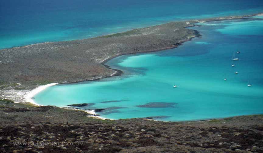
Only from the top of the island do you get any sense of its Google-sat-view. Gazing down from our bird’s-eye perch, the sky and the earth and the sea and the sand blend together in an artist’s palette of vibrant colors, swirling, shading, intensifying, fading. Indigo waters as far as you can see, shallow up to emerald, then turquoise, then brightens into brilliantly creamy sand; charcoal reefs appear as soft, mushy blobs leaking out into the sea like inkblots; our treacherous, rock-laden streambed becomes a trail of tiny cinnamon chunks from up here; tufts of blond field grass and patches of vibrant green succulent ground cover dot the landscape; the distant Gigantas mountains are a long, undulating, gray smear in the distance; white clouds streak in unison across a never-ending cornflower sky. Magical.
Getting Back Down
But, like those who scale Mt. Everest, you can’t stay long. Gotta get back down. And that can be the hardest part. Skidding down the gravel incline was faster and easier. But traversing the rock fields was a tedious balancing act. Already exhausted, we were more likely to mis-step onto a wobbly rock now than at any point. Several times, I almost lost my footing due to lack of concentration, performing those arm windmills again. But we made it back down in one piece…no broken ankles. But oh, how we ached from head to toe!
Am I glad we did it? Yes. Wanna go again? Hell, NO!


 RSS Feed
